M/Cing to SA: We make it to La Paz in time for Carnival

We thought getting on and off this ferry would be the major challenge ofthe day. Boy were we wrong.
The longest day: 175 miles of thrills, near spills, high anxiety, confusion, Carnival celebrations, and ultimate survival
After getting through a three-hour, three-bribe border crossing on our way to La Paz , we thought everything would be downhill from there. Then, when we muscled our way on and off a rickety wooden ferry without falling into the lake, we were ecstatic to be on solid land again. We just knew it would be smooth sailing into La Paz, just 70 miles away. After we were led through the worst traffic of the trip on the outskirts of La Paz by yet another good Samaritan to our intended hostal, we thought we were minutes away from a cold one in said hostal’s in-house brewery. Not so, but two hours later KR came back with good news from an on-foot reconnaissance trip : we had a hotel just down the street. Wow, we had beat the zero occupancy of Carnival weekend! Forty minutes later I had bobbed and weaved my way through traffic to make it the five blocks to our hotel only to be confronted by… a garage entrance that was smack in the middle of this neighborhood’s Carnival celebrations. With KR holding back the the traffic, I felt like an Indy 500 winner as I successfully charged between two street vendor’s stalls, jumped the curb, and dissapeared through the door down into our underground hotel parking garage. High fives all around as we had somehow made it through this day with no new scratches to person or machine. We celebrated with a glass of vino at a pizza shop (pizza is Bolivia’s favorite type of restaurant) 13 hours after leaving Puno.
Bolivia had always been on my “be careful” list, as in be careful of the lack of good roads, of rain, of street protests, of poverty, of the gasoline, of their corrupt officials and petty and not so petty thieves. KR was worried too and had been combing other motorcycle blogs for road conditions for weeks prior to our going to Bolivia. Yet none of these worries proved to be too challenging. Yes, the roads weren’t terrific, gasoline stations were few and far between, it rained as often as the sun shined. Moreover, we had searched for, received and taken all the advice we could get about how to handle Bolivia. None of these efforts and cautions were worth a damn. As we know so very well, sometimes shit happens and you just need to deal with it…
- We went off the main route to an out-of-the-way Peru/Bolivia border crossing because we were advised that it would be deserted, quick and hassle-free. Not so fast for us. After convincing a Peruvian immigration official that our lack of tourist card could be remedied with a $20 bill, and helping a Peruvian police official agree that a digital proof of insurance card would be acceptable (it wasn’t stampable) with another $30, and paying $270 for a Bolivian visa, and waiting 90 minutes for the Bolivian customs office to open after lunch, and finally agreeing with a Bolivian police officer that he indeed deserved financial remuneration ($3), he lifted the bar blocking the road and we rolled into Bolivia. A scant three hours later 🙂
- We were also advised that this alternate route would be shorter, faster and more beautiful than the normal Panamericana Highway route. It would also avoid all the traffic of Julicaca. a well-known traffic nightmare. The only hitch would be a short ferry ride across the lake to the north side. The road was indeed wonderful and the view of Lake Titicaca shimmering below as we rose to 14,000 feet was awe inspiring. We were encouraged as we came off the mountain and saw a small flotilla of ferries scurrying between shores. This was obviously a water transportation system. That proved total bull shit as we were hurried past all the inspectors and were directed toward an awaiting ferry. As I approached said ferry, I was surprised mid-way through the curb jumping that there were significant gaps in its floor boards — gaps large enough to swallow an entire wheel. Somehow I avoided falling into these gaps only to notice one of this ferry’s most notable features — unlike every other ferry we’d been on in the world, one had to back up to get off the ferry instead of simply driving forward. So, after wallowing across the channel, KR, the “captain,” his mate, and I muscled NV back and up the ferry’s deck, once again avoiding all gaps, jumping the exit curb, and maneuvering down the ramp without dumping said vehicle in water or on the ground. Relieved doesn’t describe how we felt having met this latest challenge. Although it was getting on toward 4:00PM, we were comforted that La Paz was just 70 miles away, all on terafirma.
- About 10 miles outside of La Paz it started to rain hard and the traffic started to slow. This made it difficult to see while lurking along in the stop and go. Instead of getting better, the traffic just got worse as we got closer to the city. There was a lot of partying going on next to the road (heck it was happening in the road too) with people dancing, bands playing, and people getting totally blitzed. Pretty impressive neighborhood party we thought, having no idea or sense of time/date. Traffic was now a real-time nightmare. One side of the divided highway had been closed off for the party’ers, squeezing all traffic on just one side. Which side was open to traffic alternated every few blocks, making kamakazi kinds of lane switching into on-coming traffic a frequent occurance. We couldn’t see an end to this mega-jam as we were squeezed in between buses, trucks, cars, taxis, SUVs, ambulances, police vehicles and anything else that would move. A red SUV with a family inside jerked up along side us. “Where are you going?” I think he said. “La Paz” we answered. Duuhh! He motioned for us to follow him and, not having a better plan or other option, we tried to do so. For a couple of miles we swerved through traffic, down little back streets, and made a couple of U-turns to arrive on a wide divided highway high in the mountains. As we entered the highway, there spread out below us was La Paz — a huge city built over dozens of hills at 12,000+ feet. Our good Samaritan pulled over, suggested we take a picture here (we did) and then offered to take us to our intended hostal. Five minutes later we were in front of the hostal and our friends in the red SUV were waving and driving off.
- KR walked out of our intended hostal with a frown on her face. “Did you know it was Carnival this weekend? They don’t have any room!” Hell, I wasn’t entirely sure what month it was, let alone remembering that Carnival was the first week in March. More specifically, this Saturday night was the big Carnival celebration in La Paz. We had no pre-selected hotel alternatives, it was closing in on 6:00PM, and we didn’t have the slightest idea of where we were since we had no map of La Paz. We got a couple of recommendations from the folks who turned us away, so we tried to erase the disappointment of no brewskies yet and began to navigate to the alternatives using a small advertising map of the local area. One thing needs to be emphasized here: La Paz is built in the hills and mountains. There are few flat stretches, most roads are going up, down or jagging across steep, steep hills. For the next 60 minutes we ride up and down these hills (executing two perfect U-turns on steep, steep hills in the process), without finding our intended targets. Finally we get a tip that a hotel across the canyon has both a room and a garage for NV.
- It was now dark and the city was afire with Carnival celebrations. The traffic, or more accurately the cut and thrust of anything with wheels, was beginning to make Kathmandhu’s look tame. Horns honked, buses rumbled into too-small spaces, pedestrians drunkenly played chicken, taxis stopped at any moment to take on or disembark passengers, fireworks shot off from all directions , bands were playing in the street and … into the middle of this we plunged, just trying to find a street sign, an address, or a hotel sign. For once, I was calm inside without the usual OH-SHIT anxiety that comes from dangerously slow-speed muscling of NV in crazy cities. But on this night, at this time, I was on my game. Making moves that were unthinkable just weeks before, we avoided buses, people, taxis, man-eating potholes, and everything else that could be thrown at us. I approached everything matter of factly. Bus about to run over my left foot? No big deal, hit the horn, lift the foot, and hit the throttle to spurt in front. Need to make a U-turn from uphill to downhill after hitting a dead-end? No big deal, KR’s gets off and helps guide us back down the hill to make a perfect Y-turn. On this day and at this moment, we were good.
So, on this “short” 175 mile day, KR and I had earned another Adventure Guy stripe. It wasn’t like we had waded through rushing rivers, or swagged our way through a jungle, or plowed mile after mile down a sandy wash. No, for us, we had simply survived everything that had been thrown at us and handled it. It wasn’t always pretty, it certainly wasn’t done with bravado, but we handled whatever “it” was with a calmness and a resoluteness we didn’t have two-plus months ago.
Geez, I need a drink just thinking about it.

After successfully getting through Peruvian Immigrations, Customs and Police offices with just two bribes, we thought it would be all downhill on the Bolivian side. The police officer taking this picture was smiling too as we had just contributed to his kid's college education.

KR descends into the Bolivian Immigration, Customs and Police stations. We were done a short 2 hours and $270+ dollars later.

The fleet of ferries looked professional from afar...

KR holds Now Voyager steady as we roll across the straight.

Our captain uses modern equipment to keep our vessel pointed in the right direction.

The road from the border to La Paz was scenic and made for easy riding. La Paz is near the snow capped peaks in this picture.

Our La Paz traffic nightmare begins about five miles out. This is one of the few "action" shots as KR was too busy looking at maps and giving me real-time directions. Oh, and she probably had her eyes closed most of the time: )

We had no idea that the San Pedro neighborhood that we drove into was party-central for Carnival. Streets were jammed with revelers for days and nights.

This shot is taken from NV as we're parked waiting for KR to come back from a hotel scouting run. A continuous stream of taxis would pull up, their passengers would pop out and run into one of the stalls pictured here, and return with arms full of booze and ice. It seemed that we had parked on Liquor Store Row with stall after stall of booze. I looked on jealously.

La Paz's Carnival reminded me of Mardi Gras as groups/clubs/teams would dress up and dance in the streets. This guy kind of looks like the Joker, while

these folks were dressed more traditionally.

Some of us didn't have to dress up to scare anyone. Most of the time people looked at us like we were from another world anyway.

Police officer appears to be saying, "Are you going to walk the line or not?"

Even huddles of more "Mature" women got into the spirit of things. These women were passing around large bottles of beer.

This is shot from our hotel room on a SUNDAY morning..

The target. The brown double door in the center is where I had to put NV through at night, with the street jammed with people, stalls, cars and bands.

The first thing one notices when crossing from Peru to Bolivia is that building materials change from the stone/adobe of Peru to big, solid red bricks in Bolivia. This shot of a La Paz hill is typically dominated by red brick structures, giving the entire city a monotone look of dark red.

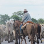
There are lots of colorful markets in La Paz. Here one of the sellers takes stock as a potential customer approaches

What is it? I didn't ask nor did I volunteer to taste.

Given its monochromatic background, La Paz's streets are wildy colorful at ground level is colorful stalls, food, flowers and dress.

La Paz won't win any "most charmingly beautiful" city awards. Most of what we've seen is either red, really ugly, or downright weird. This shot is typical. Aside from aesthetics, La Paz is a vibrant, kind of gritty big city that feels much smaller because it fills the mountains/hills nearby. The neighborhood we're staying in -- San Pedro-- is a weird combination of San Francisco's Haight, NY's Little Italy, with the outdoor market feel of Mexico.

Is he real or made of wax? KR's growing collection of Peruvian and Bolivian children is amazing.
About 10 miles outside of La Paz it started to rain hard and the traffic started to slow. It made it difficult to see while lurking along in the stop and go. Instead of getting better, it just got worse as we got closer to the city. Pretty soon we noticed that there was a lot of partying going on next to the road (heck it was happening in the road too) with lots of people dancing, bands playing, and many people totally blitzed. Pretty impressive neighborhood party we thought, having no idea or sense of time/date. Traffic was now a real-time nightmare. One side of the divided highway had been closed off for the partiers, squeezing all traffic on just one side. This side alternated every few blocks, making kamakazi kinds of lane switching into on-coming traffic a frequent occurance. We couldn’t see an end as we were squeezed in between buses, trucks, cars, taxis, SUVs, ambulances, police vehicles and anything else that would move. A red SUV with a family inside jerked up along side us. “Where are you going?” I think he said. “La Paz” we answered. Duuhh!” He motioned us to follow him and, not having a better plan or other option, we tried to do so. For a couple of miles we swerved through traffic, down little back streets, and made a couple of U-turns to arrive on a wide divided highway high in the mountains. As we entered the highway, there spread out below us was La Paz — a huge city built over dozens of hills at 12,000+ feet. Our good Samaritan pulled over, suggested we take a picture here (we did) and then offered to take us to our intended hostal. Five minutes later we were in front of the hostal and our friends in the red SUV were waving and driving off.


WOW, it all looks fantastic. Happy to see and hear about all your experiences. Ann says hi.
What explains all the color in that part of the world? With the exception of that one shot of the dark red monotone city on the hillside, the rest is like a rainbow; better even. We don’t have that here in the US, do we? Not in Europe either, right?
I am so impressed with you two!!! I may know a couple things about riding a bike in the dirt/sand/rocks but you have it WAY over me. You are having a much better time and it’s fun to read.
Hi Freddy and Karen we met you in La paz the intrepid Aussie trekkers to Machu Pichu ! Perfect weather the trek was inca steps up, up and up! Good group of 10, handsome peruvian guides the whole experience was exceptional the weather as well.. Freddy Amanda wants to say don´t ever doubt her again and she didn´t come down on the donkey just her backside a couple of times… will send photos now in fab BA off to Colonia tomorrow… Cheers Rosemary. your website is terrific
Let’s meet up in Colonia on Saturday?fw